We're back home and mostly unpacked after a 4-day backpacking trip in the Grand Canyon. Our friends Whitney & Jeff had a permit and invited us, along with their friends Jim and Kiryn. We started at the North Rim (8200') down the North Kaibab Trail to the Colorado River (2450'), and then up to the South Rim (6860'). 14 miles down, 9.5 miles up. Then we caught a shuttle bus back to our vehicles at the trailhead on the North Rim. We camped at the bottom of the canyon, and at midpoints on each side; that made for fairly easy hiking days.
Yes, it was hot! But we managed by hiking early in the morning, soaking our shirts in the creek when we could, and relaxing in the shade during the heat of the day. At Phantom Ranch (the bottom of the canyon) it was 107F in the shade! Maybe that's why I forgot to take any pictures there...
My Picasa web album for the backpacking trip
Wednesday, June 20, 2012
Saturday, June 2, 2012
Surprise and Amphitheater
What a difference a few days make! Last Sunday Eric and I were hiking in a snowstorm at 8000'. Today we hiked up to Surprise and Amphitheater Lakes; yes, in the snow, but under very different conditions. We were comfortable in t-shirts and shorts at 9800'.
There was patchy snow on the trail starting at about 8500', in the shaded spots. By 9000' we were hiking on all snow. Fortunately, the snow was well-consolidated and supportable, there was almost no post-holing going on. Above 9500' there was a top layer of 4-6" of mush from last weekend's storm cycle.
We got the opposite of an alpine start; we left Lupine Meadows trailhead at 2:45, but that was p.m. rather than a.m. We met a half-dozen people coming out from the lakes, but saw nobody once we were up there. We ate a quick snack at Surprise Lake,
sat in the sun for a few minutes at Amphitheater Lake,
and then hiked up to the col between Amphitheater Lake and Glacier Gulch. We were hoping for views of the Teton Glacier; it was hidden around the corner so we had to settle for the moraine instead.
Then we headed back down; 3100 vertical feet later we were back at the car by 7:15. A very pleasant late afternoon stroll!
Sunday, May 27, 2012
A typical Memorial Day weekend
Jill and I spent the past week in southeast Nevada, watching the eclipse and then exploring Great Basin National Park. We got home Saturday evening to a typical Jackson Hole Memorial Day weekend, 40 degrees and raining! Sunday morning we saw snowflakes, some of which managed to stick to the grass in the yard.
Eric was getting cabin-feverish after most of a week indoors working, and then watching the lousy weather on his days off. He suggested a hike somewhere just to get out of the house, after all, we do have Gore-Tex and fleece! Jill stayed home to catch up on tasks, Eric and I decided on Granite Canyon. There was a sloppy wet inch of snow at the trailhead. We saw two skiers hiking out at the bottom of the canyon; otherwise we had the place to ourselves. We turned around after about two hours, a little bit short of the forks; 5-6" of wet snow at that elevation (8000') was starting to make for tedious walking.
Friday, May 25, 2012
Lexington Arch
Lexington Arch is a six-story limestone arch, located in the southern part of Great Basin National Park. It sounded like a good objective for our last day in the park, before we started heading homeward.
The trailhead is 12 miles from the highway, all of it on BLM gravel roads. Hmmm, I don't think we want to pull our Scamp trailer all the way in there.... Fortunately, we found a small pullout area just off the highway, and stashed the trailer there for a few hours. There were also several other usable places in the first 3 miles from the highway.
The BLM district in Utah must have more funding than its counterpart in Nevada. The first 3 miles of road, still in Utah from the highway to the Nevada border, were well-graded and maintained. Once we crossed back into Nevada, the road became just a typical desert two-track; nothing awful, doable in a passenger car under most conditions, but a marked contrast to the Utah side of the border.
The hike to the arch was straightforward, 1.5 miles in and 1000' up. The trail is mostly in open terrain and would be a scorcher in hot weather. The arch was impressive, well worth a few hours round trip.
The trailhead is 12 miles from the highway, all of it on BLM gravel roads. Hmmm, I don't think we want to pull our Scamp trailer all the way in there.... Fortunately, we found a small pullout area just off the highway, and stashed the trailer there for a few hours. There were also several other usable places in the first 3 miles from the highway.
The BLM district in Utah must have more funding than its counterpart in Nevada. The first 3 miles of road, still in Utah from the highway to the Nevada border, were well-graded and maintained. Once we crossed back into Nevada, the road became just a typical desert two-track; nothing awful, doable in a passenger car under most conditions, but a marked contrast to the Utah side of the border.
The hike to the arch was straightforward, 1.5 miles in and 1000' up. The trail is mostly in open terrain and would be a scorcher in hot weather. The arch was impressive, well worth a few hours round trip.
Thursday, May 24, 2012
Baker Lake non-loop
We were going to do a loop hike in Great Basin National Park: up Baker Creek to Baker Lake, over the divide to Johnson Lake and then down Johnson Creek and across to the Baker Creek trailhead. As it turned out, May 24 was too early in the season, even in a low-snow year.
The Baker Creek trailhead is at 8000', at the end of a well-maintained gravel road. We saw a couple other cars at the trailhead, but never saw anyone else while on the trail. On the way to the lake, we hiked past one area with some very impressive avalanche damage, lots of large (12" +) trees littered like matchsticks at the bottom of a large bowl.
Baker Lake is a typical pretty mountain cirque lake...
The maps we had showed different routes for the trail between Baker Lake and Johnson Lake. Some showed the trail directly at Baker Lake, others showed it about 1/2 mile down below the lake. We didn't see a trail junction on the hike in; after less than a minute of exploring at Baker Lake, we found the well-cairned route to Johnson Lake.
The cairns were very large, usually 2 feet tall, and spaced very closely, rarely more than 30 yards apart. It was obvious, though, that the route had been laid out later in the summer after all the snowmelt was gone...
The small pond was easy to bypass. The route led up to the divide between Baker Creek and Johnson Creek, elevation 11300 or so. The views were impressive.
From the divide, we could look over and see Johnson Lake just below us. However, there was a snowfield on that side of the divide that would be more accurately described as the remains of a huge cornice, with a near vertical face dropping into a very very steep bowl. There was one small snow-free section, Jill thought it looked passable but I thought it too steep for my comfort level. So instead of a 13 mile loop, we did a 12 mile out-and-back. What is the opposite of a loop? At least we did get to see Johnson Lake...
Wednesday, May 23, 2012
Wheeler Peak
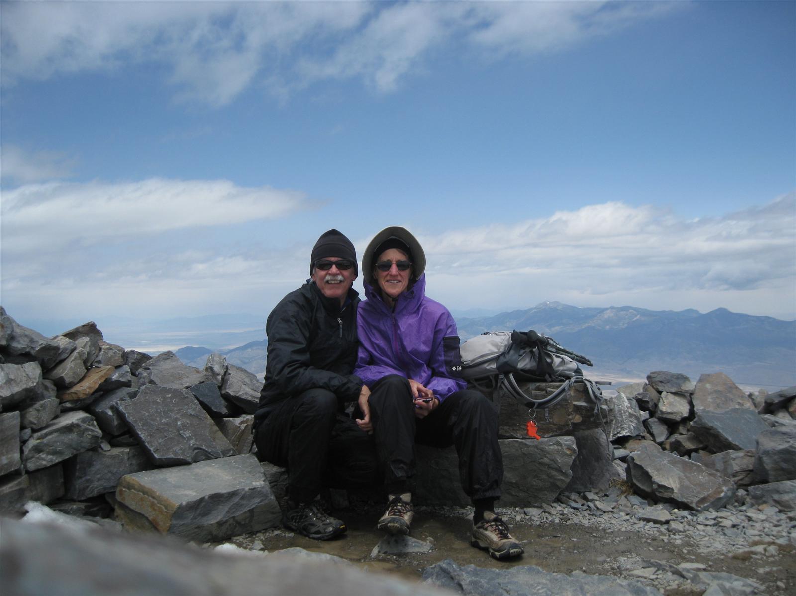
While we were in Great Basin National Park, Jill and I couldn't pass up the opportunity to hike to the top of Wheeler Peak. It is the second highest peak in Nevada at 13,063'. The trail is a straightforward 8.4 mile round trip on a good trail.
The weather had turned cooler and breezy, temperatures in the 40s and winds 15-20 mph.The most-exposed section of the trail (ridgeline between 11,000 and 12,500 feet) was a bit unpleasant. Nearing the summit, the trail wound around to the sheltered side of the mountain. Surprisingly, the summit was not very windy at all compared to the lower ridgeline.
Yes, that is a Blackberry in Jill's hand. But there's no cellphone coverage to speak of (with?) there....
And a 360-degree panorama video....
Our GPS track is online at my EveryTrail page.
Tuesday, May 22, 2012
Caves and bristlecone pines and ...
... rock moraines, not to mention mountain peaks, glaciers, and alpine lakes.
Great Basin National Park has been on our to-do list for quite some time now. We were already in southeast Nevada to see the annular eclipse, so what better time? After a stop in Ely NV on Monday for a new trailer battery, minor medical services, and some quality internet time on the Blackberries, we pulled into the Lower Lehman Campground about 6pm. We were just in time to snag one of the few remaining campsites. This campground and the Upper Lehman Campground filled up that evening; later in the week that they were not as crowded. Apparently we weren't the only people in the area who had come for the eclipse and then stayed for Great Basin NP.
We had made advance reservations for a tour of the Lehman Caves on Tuesday morning. The tours do sell out ahead of time (ours did), so making reservations in advance is highly recommended. We picked the 90-minute Grand Palace tour. It is an amazing place, discovered in the late 1800s by a local rancher. We enjoyed the tour immensely...
After lunch we drove to the end of the Wheeler Peak road at 10,000' and went for a hike. There are 3 trails that leave from this trailhead: Bristlecone Pine loop, Glacier and Rock Moraine trail, and the Alpine Lakes Loop trail. They're all fairly short, so we did all of them for a total of 6-7 miles. (Click on any of the photos for a larger view...)
Great Basin National Park has been on our to-do list for quite some time now. We were already in southeast Nevada to see the annular eclipse, so what better time? After a stop in Ely NV on Monday for a new trailer battery, minor medical services, and some quality internet time on the Blackberries, we pulled into the Lower Lehman Campground about 6pm. We were just in time to snag one of the few remaining campsites. This campground and the Upper Lehman Campground filled up that evening; later in the week that they were not as crowded. Apparently we weren't the only people in the area who had come for the eclipse and then stayed for Great Basin NP.
We had made advance reservations for a tour of the Lehman Caves on Tuesday morning. The tours do sell out ahead of time (ours did), so making reservations in advance is highly recommended. We picked the 90-minute Grand Palace tour. It is an amazing place, discovered in the late 1800s by a local rancher. We enjoyed the tour immensely...
After lunch we drove to the end of the Wheeler Peak road at 10,000' and went for a hike. There are 3 trails that leave from this trailhead: Bristlecone Pine loop, Glacier and Rock Moraine trail, and the Alpine Lakes Loop trail. They're all fairly short, so we did all of them for a total of 6-7 miles. (Click on any of the photos for a larger view...)
Bristlecone pines are very long-lived, found only in the higher mountain elevations of the Southwest. Great Basin NP has several bristlecone pine groves. Some of the trees here are over 3000 years old. At these elevations (above 10,000') they get exposed to some extreme weather and look as if they've led very hard lives.
(Umm, just to make myself clear here, I do mean the trees look as if they've led very hard lives, not the people...)
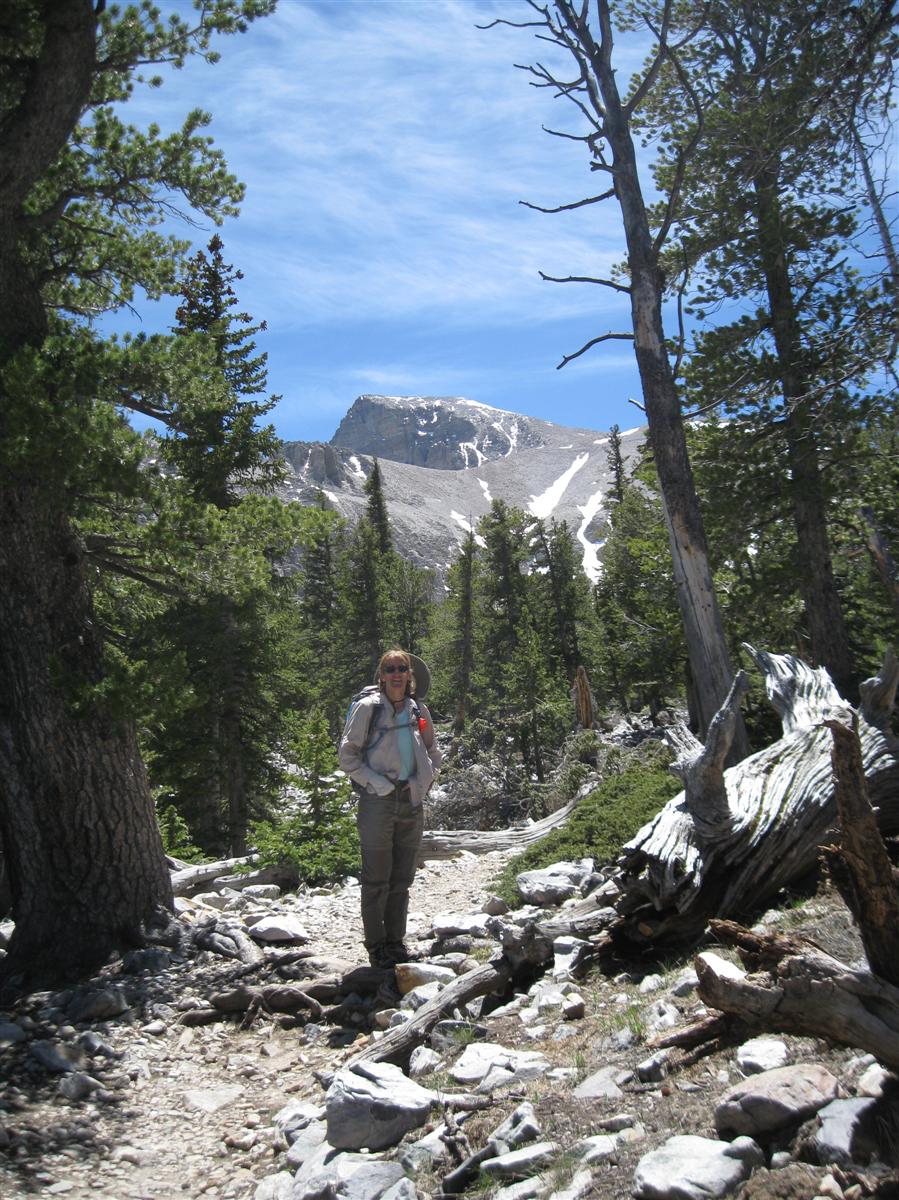
From the Bristlecone Pine loop, we continued on to the Glacier and Rock Moraine trail. We reached an elevation of about 11,000' and had some nice views of the SE side of Wheeler Peak -- our planned destination for Wednesday's hiking. (It's the peak on the right)
Just before reaching the trailhead on the way back down, we turned left and began the Alpine Lakes Loop trail. This trail took us past Teresa Lake ...
... and Stella Lake, with Wheeler Peak in the background.
Subscribe to:
Posts (Atom)