Wednesday, April 21, 2010

Snowy Death Valley

Another desert hiking trip ends with a snowstorm!


I decided to leave a day early, the wind and rain had been going on steadily overnight. At the higher elevations (above 3000 feet!) it was snowing. This picture was on the Daylight Pass road on the way to Beatty Nevada.

Monday, April 19, 2010

Lower Telephone Canyon

A short hike on the west side of Death Valley National Park. Telephone Canyon was the stage route (and telephone route!) between the mining towns of Rhyolite Nevada and Skidoo Calfornia back around 1906.

Telephone Arch is small but unusual, given the kind of rock and soil here.

There was a stage stop at the spring in the canyon, but the spring dried up many years ago. Here is what's left of the arrastre, a horizontally-oriented water wheel.

Other than that, it's a nice desert wash but nothing really out of the ordinary. One side canyon has a short section of narrows that are pretty, one side wash turns into a slot that ends in a 25-foot dryfall grotto with nearly vertical walls. I couldn't get the whole thing in one picture, so here are my hiking poles and the bottom half of the fall.

I went up a couple of miles and turned back around, though there is a lot more of the same going all the up to the Skidoo area, 8 miles and 3000 vertical feet from the entrance to Telephone Canyon.

Lower Telephone Canyon at EveryTrail

Sunday, April 18, 2010

Lower Bighorn Gorge

A long hike in the northern part of Death Valley National Park, one that I've had my eye on for a while. The problem is, it's a long walk. Here's the picture from the truck, the mouth of the gorge is 4.5 miles away.

1.25 miles downhill to Death Valley Wash, then 3.25 miles up the wash to the mouth of the gorge. Walking was easier up on the bajada (the alluvial fan) rather than in the wash itself; the bajada is mostly well-cemented small stones. The wildflowers were really nice, including the desert globemallow here

From the mouth of the gorge, the next two miles in the gorge didn't change much. So I decided to call it a day here. Just as well, by the time I got back to the truck I had almost finished three liters of water that I was carrying.

Next time I'll try the upper end of the gorge; it takes a thirty-mile drive on rough roads to get there!

Lower Bighorn Gorge at EveryTrail

Saturday, April 17, 2010

Racetrack Valley

So a driving excursion to an interesting part of Death Valley National Park, with some very unusual features. The purple wildflowers carpeting the valley floor near Ubehebe Crater were impressive. (Click on any of the pictures to enlarge)


After twenty-plus miles of badly washboarded gravel road, you come to Teakettle Junction. Apparently this junction originally did not have a sign, just a teakettle on the ground. Now it has a lot more, obviously.


Racetrack Valley is named after Racetrack Playa, a fairly typical dry lake bed with an interesting rock island in the middle.


But what makes Racetrack Playa interesting is the rock trails in the playa, as in trails from where the rocks moved on the playa! Here's one with my large daypack for scale.


There are a few rocks scattered about the playa, but at the south end there is a pretty impressive collection. (Click on the photo to enlarge it, well worth seeing, trust me...)


Best guess is that when there has been enough rain for the surface to turn muddy and slick, high winds can slide the rocks along. On a nice Saturday afternoon in April, this was a popular area considering that it's about thirty miles from the nearest paved road. I saw at least fifty vehicles, and twenty dirt bikers. Some passenger cars do drive the rough road in from Death Valley, just have to take it easy on the rocky road and try not to puncture a tire; I was happy to have a truck with heavy-duty tires.

I also did a bit of hiking up from the playa, two miles and 1200' up an old mining trail to Ubehebe Divide, where I had almost 360 degree views with the Racetrack Valley to the east and Saline Valley to the west.

When Jill and I were visiting the park back in February, we were told the playa was wet and you weren't allowed to walk out on it (because of leaving footprints).  This was worth the return trip...

Friday, April 16, 2010

A no-name canyon in Death Valley

Some random exploring at the north end of Death Valley, I saw one canyon wash that looked interesting. After that wash became too bouldered for easy travel, I went to the next wash south. It was a lot more interesting, although the lower part of the wash is fenced off as part of the Grapevine Springs area.

The wash narrows down somewhat, then eventually opens up again. That's where I turned around; it looks like you could follow this one for quite a ways further.

Saw *lots* of mountain lion scat through the narrower section, though none of it looked recent (and that was fine with me!). All of the scat was well-dried, and much of it was baked almost white. In places that were well-shaded by rock overhangs, there were sometimes as many as a dozen scat piles. It looked like a litter box that needed cleaning. Alas, I didn't think to take any pictures of those.

GPS details at EveryTrail

Thursday, April 15, 2010

Lower Willow Canyon, Death Valley

Lower Willow Creek canyon is an easy hike, as long as it's not a hot day! Two miles of exposed desert wash hiking,

then a quarter-mile or so of nice narrows,

ending at a 40-foot waterfall complete with running water.

This picture doesn't do justice to the falls, it's a really pretty spot. The trailhead is the same one as Sidewinder Canyon so it's easy to do both canyons. This is all low elevation (the trailhead is at -220 feet), I wouldn't want to hike this in the summer heat.

GPS details at EveryTrail

Wednesday, April 14, 2010

Scotty's and Ashford Canyons, Death Valley

Aha, two interesting canyon hikes from the same trailhead! In the south end of the park, where the remains of the Ashford Mill are just west of the Badwater Road, a rugged road heads east up to the trailhead for Scotty's Canyon and Ashford Canyon. The first part of the road (2.8 miles) is doable with a passenger car, but it gets progressively rougher and steeper. I was glad to have 4WD for the final half-mile or so, mostly for the low-range gearing.

Scotty's Canyon is named for the legendary Death Valley Scotty, this canyon was his favorite hangout, here in the first grotto about 3 miles from the trailhead.

The fall is not easily climb-able, but can be easily bypassed on the right side, about 100 feet downcanyon. Here's another view of the same grotto, but from above the wash.  There is dripping water in the shady area on the right, really a neat place.

Above here there was a little bit of running water in the canyon. The second grotto is about a tenth of a mile further, guarded by a catclaw acacia tree that left its claw marks on me. I thought the second grotto was prettier, though it didn't have the dripping water effect.

The dry fall at the second grotto is easy to climb on the right side.The third grotto is another quarter-mile or so, and above that there is a very large rockfall zone (very large boulders, and lots of them) that looked like heavy going. The guidebook (Michel Digonnet, Hiking Death Valley) says that the going gets really ugly above that point, so I turned around.

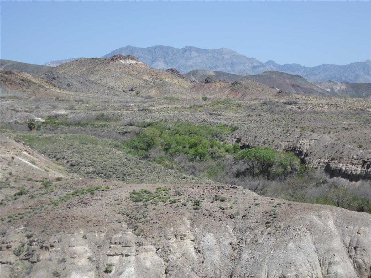
Another vehicle followed me in to the trailhead, they were headed into Ashford Canyon so I had Scotty's all to myself. Back at the trailhead, their truck was still there... heh, here I had been hoping for my own personal private Ashford Canyon as well (not that it matters!). This is the view of the Ashford Canyon wash from the trailhead.


The main reason to hike Ashford Canyon is for the mining ruins, though there is supposed to be some interesting climbing on the dryfalls in the lower canyon. About a mile into the canyon, I met the couple who owned the truck, they were hiking out but hadn't found the mine they were looking for. I made it up to the Ashford Mine camp, a little over two miles from the trailhead. The cookhouse and bunkhouses are still standing. There are also a lot of mine shafts and prospects in the area.


Had I been really energetic (and started earlier in order to have more daylight) I could have gone another two miles and 2000' vertical up to the Desert Hound Mine. The guidebook says it is a much more difficult hike; the Desert Hound can also be reached from Virgin Spring Canyon (yesterday's hike).


GPS details on EveryTrail

Tuesday, April 13, 2010

Virgin Spring Canyon, Death Valley


The first day of a Death Valley trip. After a driving tour of the Greenwater Valley (with some hiking around the old mines at Furnace and up to the divide there), I did a short hike up Virgin Spring Canyon in the southern end of Death Valley National Park. The spring is dry and clearly has been for a number of years. The tank in the picture, and an old bathtub next to it, were originally placed there back when the spring was running. After hiking another mile upcanyon to some ruins of stone houses used by miners in the canyon approximately 1906, I called it a day and headed back to the truck before running out of daylight.


GPS details of the hike on EveryTrail

Saturday, April 10, 2010

Spread Creek Saturday

Dave, Gail, and I went for a short hike on the Spread Creek ridge. There aren't many snow-free hiking options yet in the valley, but the south side of the ridge and the ridgeline itself was clear. The snow on the north side was 1-2 feet deep, mostly supportable crust except for the occasional postholing.

Alas, we didn't see any wolves or bears but did see several moose, a few scattered bison, and a large band of elk. The views from the ridge heading back to the road are hard to beat!